Mnisose
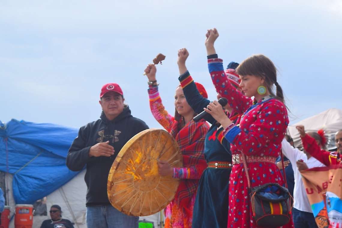
From the Series: Standing Rock, #NoDAPL, and Mni Wiconi
From the Series: Standing Rock, #NoDAPL, and Mni Wiconi
Mnisose, the Missouri River, is a living being. She flows from the confluence of two smaller rivers whose headwaters are in the Rocky Mountains. Her sinuous body weaves through three states and creates a border between four more before sinking her mouth into the Mississippi River, not too far north of Cahokia. Throughout her life, Mnisose has nurtured the adjacent fertile bottomlands by intermittently inundating them with upriver nutrients, and she serves as a transportation corridor for peoples and their nonhuman relatives. Her waters and riparian areas provide sustenance to countless living beings.
In the middle of the last century, the United States proposed a massive public works project to control the seemingly unpredictable fluctuations of Mnisose. Officially titled the Missouri River Basin Development Program, the Pick-Sloan Plan was approved by Congress as part of the Flood Control Act of 1944 and called for the construction of over one hundred dams within the Mnisose basin, which would ostensibly provide flood control, help regulate crop irrigation in the region, and provide the infrastructure to produce hydroelectric power. The Pick-Sloan Plan had eerily similar elements to the Dakota Access Pipeline: the Missouri River, an enormous construction project that would create hundreds of new jobs and supplement an energy source, the Army Corps of Engineers, the states of North and South Dakota, and Lakota tribes with lands along Mnisose.
The Army Corps of Engineers was tasked with building and operating five main-stem dams along the Missouri River as part of Pick-Sloan’s implementation. The resulting reservoirs disproportionately inundated tribal lands, and the Bureau of Indian Affairs (which was supposed to act as the trustee and advocate for American Indians and Indian tribes in getting a fair price for the sale of their lands) apparently appraised tribal land at pennies to the dollar. As the water levels stabilized, it also became apparent that the Corps had acquired much more land than was necessary for the reservoirs. In response, the Standing Rock Sioux Tribe, along with the Three Affiliated Tribes, took the lead in calling for a return of their lands that were not inundated. In 1985, the Joint Tribal Advisory Committee (JTAC) was established by the Secretary of the Interior to address these claims, and the resulting report called for monetary damages to be awarded and excess lands returned.
Given that the Standing Rock Sioux Tribe has a successful legacy of fighting for water rights along Mnisose, it seems appropriate that this nation is in the vanguard of advocacy for its rights, the rights of its citizens, and the rights of all peoples in and along Mnisose against the Dakota Access Pipeline. Its actions are grounded in the history of this land and flow from the treaties its forefathers and their Lakota and Dakota relatives negotiated with the United States at Fort Laramie in 1851 and 1868. Through these treaties, Lakota and Dakota oyates reserved for themselves a large tract of their homelands centered in what is now western South Dakota, along with parts of Nebraska, Wyoming, Montana and North Dakota. The eastern boundary of this land base was set at the low-water mark of the east bank of the Missouri River in 1868. In other words, Mnisose—from the Heart River in what is now North Dakota to the northern border of Nebraska—was stipulated as belonging to the Sioux nation. When the United States took over thirty-two million acres from the southern, western, and northern areas of this land base in 1877, the eastern boundary of the diminished land base remained as specified in the 1868 Fort Laramie Treaty. But when the resultant Great Sioux Reservation was again reduced in size and then divided into six separate reservations on March 2, 1889, the eastern borders of the four newly created Lakota reservations along Mnisose (Standing Rock, Cheyenne River, Lower Brule and Rosebud) were set at the center of the main channel of the Missouri River, not the low-water mark of the river’s eastern bank. As such, the (so-called) 1889 Agreement was the first instance of the United States alienating some of Mnisose from her Lakota relatives.
The constitutions of modern Lakota tribal governments were established in the wake of the Indian Reorganization Act of 1934. By then, there were only three Lakota reservations with lands adjoining Mnisose, but their constitutions stipulate the eastern boundary of their territories as those defined in 1889, namely, the center of the main channel of the Missouri River. In contrast, the constitution of the Standing Rock Sioux Tribe specifically states that the tribe has jurisdiction over all “waterways, watercourses and streams running through any part of the Reservation.” This unique provision foreshadowed the leadership that the Standing Rock Sioux Tribe currently takes among its fellow Lakota governments in protecting water and water rights. The protection of the Standing Rock Sioux extends beyond their own reservation, all along the watersheds of these waterways, from their origins to their mouths and beyond.
Citizens of the Standing Rock Sioux Tribe and their allies are leading the way in advocacy for Mnisose, their relative. Under the guise of fighting for and protecting their water rights, they are being good relatives—the “ultimate aim” of Lakota life (Deloria 1998, 25). It is one of the ways of being in this world that connects back to the Lakota world before pipelines threatened to burrow under the belly of Mnisose, before the dams tried to control Mnisose, before the boats plied above the backbone of Mnisose. People are ephemeral; Mnisose is eternal.
Standing Rock is where the people are gathered to protect their relative right now. She has nourished us since time immemorial. As good relatives, one of our responsibilities is to reciprocate that life-giving kindness. This is our time to stand up for our relative. That sentiment—a cultural imperative, no less—is embodied in the simple phrase “No DAPL.”
Craig Howe is the founder and director of the Center for American Indian Research and Native Studies. He earned a PhD from the University of Michigan, and previously served as Deputy Assistant Director for Cultural Resources at the National Museum of the American Indian and Director of the D’Arcy McNickle Center for American Indian History at the Newberry Library. He is an enrolled citizen of the Oglala Sioux Tribe.
Tyler Young is a research assistant at the Center for American Indian Research and Native Studies. He earned a Bachelor of Science degree in Aerospace and Mechanical Engineering from Case Western Reserve University. Since moving to South Dakota, he has worked as a high-school science teacher at St. Francis Indian School and participated in the Teacher-Ranger-Teacher program with the National Park Service.
Deloria, Ella. 1998. Speaking of Indians. Lincoln: University of Nebraska Press. Originally published in 1944.