Continental Collision
From the Series: Geological Anthropology
From the Series: Geological Anthropology

“Eastern Turkey has for thousands of years been a region of convergence for European and Asian peoples, a region where eastern and western cultures come together” (Sandvol, Turkelli, Barazangi 2003). So begins a geophysics article from 2003 on the tectonic evolution of eastern Anatolia. Referring to the continental collision of Eurasian, Arabian, and Anatolian tectonic plates in present-day Turkey, the authors continue: “Similarly, for the last 10–20 million years the tectonics of Turkey and the Anatolian plateau can be described as the convergence of three continental plates [that] form a diverse suite of tectonic boundaries.” Their assertion implies that plate movements and boundaries can neatly correspond to cultural-political geographies, resonating with the popular presentation of Turkey as a symbolic and a geophysical bridge between Europe and Asia, where different cultures and continents “come together.”

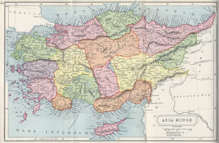
Encyclopedic sources define Anatolia (from the Greek, “east” or “sunrise”) as a large peninsula in West Asia and the westernmost part of the Asian continent that makes up the majority of present-day Turkey. In contrast to these accounts, the precise cultural and geophysical boundaries of Anatolia, have been neither clear nor stable over the past century. My intention, however, is not to provide yet another account of how continents and regions have been discursively produced (Lewis and Wigen 1997). Instead, I am interested in exploring how the geo, as “materiality and force” (Yusoff 2018, 208), might actively figure in the making of political formations in Anatolia, a both a discursive-political and a material-geophysical entity. To this end, I offer snapshots from Turkey’s history, where the boundaries of Anatolia were unsettled by political projects and the geophysical movements of tectonic plates. These snapshots, where geological and geophysical formations fail to correspond neatly to cultural-political categories about them, point to “geopolitical collisions,” or the frictions (Tsing 2005) at play in the double configuration that is prevalent in the relationship between the geological and the political.
The tectonic and political history of Anatolia is an intriguing place to examine geopolitical collisions: whether manifested in narratives of cultural-continental overlap as the quote from the geophysics article illustrates, or exemplified in the gradual expansion of the borders of “Anatolia” in the past century as to absorb unruly spaces of Kurdish or Armenian difference into the “geo-body” (Winichakul 1997) of the Turkish nation-state. Until the twentieth century, the traditional boundaries of Anatolia in the east formed a line between the Gulf of Alexandretta and the Black Sea, bounded by the Thrace, before the river bends to the southeast to enter Mesopotamia. By the beginning of World War I in 1914, despite having lost most of its territories in the northwest during the Balkan Wars, the Ottoman Empire was still populated by a multicultural and multilingual population of Muslim and non-Muslim subjects. When the empire collapsed after World War I, the founders of the new Republic of Turkey had to recast Anatolia as the heartland of a new nation-state that was transitioning from an imperial geography into a national one. Yet such an attempt also meant redefining what the physical landmass of Anatolia embodied in official discourse.
After the establishment of the Republic of Turkey in 1923, the boundaries of Anatolia started to expand. Turkish historians, geographers, and linguists were instrumental in redefining Anatolia as the kernel of the Turkish national myth of origin. Whereas Anatolia’s boundaries were marked by the Euphrates River in the east during the Ottoman era, the nationalized Anatolia of the new Republic now encompassed a wider geography, including Kurdish (and formerly Armenian) regions east of the Euphrates. In this way, the traditional terms Western Armenia and Kurdistan were erased and replaced by the designation Southeastern Anatolia and Eastern Anatolia at the First Turkish Geography Congress that divided Turkey into seven geographical regions in 1941. Geological speculations were central to such processes of expansion and erasure. One key figure in Anatolia’s reconfiguration was İsmail Habib Sevük, a nationalist writer and later a member of parliament. In 1943, İsmail Habib Sevük (1943, 70) described Anatolia, as “a sculpted diamond that got rid of its excess,” where “excess” referred to the lost territories of the Ottoman Empire. In his travelogue Writings from the Homeland, Sevük (1943, 14) speculated about the geological evolution of Anatolia, concluding that “Asia ends not in Anatolia’s west, but where the mountain ranges that extend from the Himalayas end. Europe, does not end in the shores of Rumelia, but where the Alps end.” In Sevük’s account of geological history, the borders of Anatolia extended to encompass Kurdish regions in Turkey’s east and southeast.
Later developments in the understanding of Anatolia’s geological evolution, however, offered a different story. As the emergence of plate tectonics reshaped understandings of the geology of the Eastern Mediterranean in the 1970s, Turkish geologists examined the multiple tectonic processes that contributed to the formation of the region, and the seismic and crustal formations that have been caused by the thirteen-million-year-old tectonic collision of the Arabian Plate with the Eurasian Plate, squeezing the Anatolian Plate in the process. The plate-tectonic account of Turkey’s geology, however, undermined assumptions of a tight overlap between geology and the political unit of modern Turkey. It revealed that “southeastern Anatolia” was not, in fact, a part of the Anatolian plate; rather, it constituted the northernmost edge of the Arabian Plate. Rather than reanimating notions of cultural and national homogeneity (Kneas 2018), plate tectonics in Turkey pointed to Anatolia’s, and thus the nation-state’s lack of geological uniformity. In doing so, it unsettled the Turkish state’s claims over political and cultural unity, exposing the disjointed relation between geology and the state's territorial claims. Finally, it hinted at the risks of relying too much on geo to naturalize political and cultural territories. In a way, geological determinism backfired in this case.
The turbulent story of Eurasian-Arabian continental collision and Anatolia—as a geophysical formation and a political-cultural region—is exemplary of how earth and power might relate to each other. The geopolitical relationship here is neither that of the discursive construction of geo, nor one where political worlds are fixed by the geological. It is not a smooth and even story of co-production either. Rather, the relations between earth and power are characterized by uneven and often violent movements of geopolitical collision, out of which excess, disruption, and possibility may arise. In this case, they destabilize the existing contours of the nation-state and open it to other geopolitical possibilities.
Kneas, David. 2018. “From Dearth to El Dorado: Andean Nature, Plate Tectonics, and the Ontologies of Ecuadorian Resource Wealth.” Engaging Science, Technology, and Society 4: 131–54.
Lewis, Martin W., and Kären Wigen. 1997. The Myth of Continents: A Critique of Metageography. Berkeley: University of California Press.
Sandvol, Eric, Niyazi Turkelli, and Muawia Barazangi. 2003. “The Eastern Turkey Seismic Experiment: The Study of a Young Continent-Continent Collision.” Geophysical Research Letters 30, no. 24.
Sevük, İsmail Habib. 1943. Yurttan Yazılar. Istanbul: Ötüken Neşriyat.
Tsing, Anna Lowenhaupt. 2005. Friction: An Ethnography of Global Connection. Princeton, N.J.: Princeton University Press.
Winichakul, Thongchai. 1997. Mapping Siam: A History of the Geo-Body of a Nation. Honolulu: University of Hawaii Press.
Yusoff, Kathryn. 2018. “The Anthropocene and Geographies of Geopower.” In Handbook on the Geographies of Power, edited by Mat Coleman and John Agnew, 203–16. Northampton, Mass.: Edward Elgar.